Grand Strand Airport
KCRE — North Myrtle Beach, SC

Featured Bite Classic smashed-patty cheeseburgers and deep-fried wings from Hamburger Joe's—provided you remembered to bring cash.
Editor's Dispatch
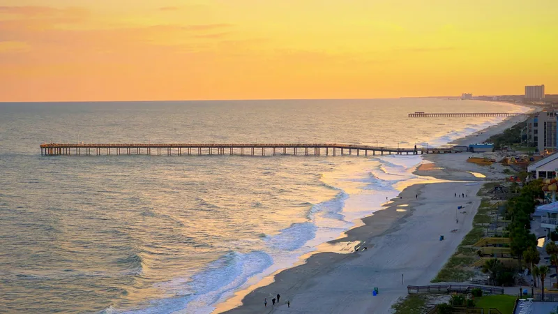
Flying the South Carolina coast usually means dealing with the airline traffic and neon sprawl of Myrtle Beach International. Grand Strand Airport (KCRE) offers a quieter, sharper alternative. You still get the visual approach over Atlantic breakers and salt marshes, but the destination is a towered 5,997-foot runway dedicated strictly to general aviation. Beach Aviation Services runs a highly efficient ramp, waiving the landing fee with a 15-gallon purchase of $5.57 self-serve 100LL. The only real hazards are the localized wildlife: gulls loitering on the asphalt and the endless parade of banner-towing 172s grinding along the shoreline between 10 NM northeast and 20 NM southwest. Keep your head on a swivel, talk to the tower on 124.6, and enjoy the coastal air.
North Myrtle Beach operates at a different frequency than the high-rise hotel canyons to the south. This is the birthplace of the Carolina shag dance, a town built on wide beaches, championship golf courses, and a stubborn refusal to rush. The neon gives way to residential neighborhoods and coastal pines. It is a refined resort community that expects money but doesn’t demand you shout about it. Highway 17 runs like a spine right past the airport fence, moving a steady stream of locals, golfers, and visiting pilots looking for a solid meal.
The food is shockingly accessible from the ramp. Just 15 minutes by foot along Terminal Boulevard puts you at The Horst Gasthaus, a wood-clad German outpost serving heavy plates of traditional schnitzel, sauerbraten, and bratwurst alongside proper German draft beer. If you need something faster, a ten-minute walk lands you at Waffle House for reliable diner food. The real local prize requires borrowing the FBO courtesy car for a five-minute drive to Hamburger Joe's. This legendary, high-volume joint slings cheap, heavily-charred smashed-patty cheeseburgers and deep-fried wings. The line moves fast, the dining room is loud, and they only take cash.
If you are shutting down for the night, the dining options step up in weight class. SeaBlue Restaurant & Wine Bar, a ten-minute Uber ride north, drops you into a serious fine-dining environment anchored by USDA Prime steaks and an exhaustive wine cellar. For a classic coastal twilight, grab a table on the back deck at Joe’s Bar & Grill overlooking the salt marsh. It sits directly behind Barefoot Landing, meaning you can walk off a heavy seafood dinner by wandering past the waterfront shops.
Grand Strand justifies the Hobbs time by making coastal flying easy. The runway is long enough for mid-size jets, the fuel is reasonably priced, and the immediate area delivers excellent food without a logistical headache. Winter is the ideal time to make the flight—the summer humidity is gone, the air is cold and dense, and you can actually get a table along Highway 17 without waiting an hour. Park the plane, hand the line guy a fuel order, and walk into town for a plate of sauerbraten. Just remember to hit the ATM if you plan on visiting Hamburger Joe's.
Nearby Food
Authentic German fare, schnitzel, and draft beer.
Standard 24/7 diner fare just half a mile away.
Legendary cheap smashed burgers. CASH ONLY.
Steaks and seafood with marsh views. Best accessed via courtesy car.
Raw bar and local seafood at Barefoot Landing.
High-end contemporary American fine dining and Prime steaks.
Featured Bite Classic smashed-patty cheeseburgers and deep-fried wings from Hamburger Joe's—provided you remembered to bring cash.
Airport data for reference only and may be outdated.
Pilot's Briefing
- Elevation
- 32 ft MSL
- Longest Runway
- 5997 ft — asphalt
- Towered
- Yes
- Approaches
- ILS OR LOC RWY 23, RNAV (GPS) RWY 05, RNAV (GPS) RWY 23, VOR RWY 05, VOR RWY 23
- Fuel
- 100LL, Jet-A
- Ramp Fee
- None
- Transport
- walk, courtesy-car, rental, uber
- Access
- Rental car or rideshare needed for most dining options
- Links
- SkyVector · Google Maps
- Last Verified
- Apr 2026
Warnings
- !Extensive banner tow operations along coastline from 10 NM NE to 20 NM SW.
- !Gulls present on and in the vicinity of the airport.
- !Activate lighting (HIRL, REIL, MALSR) after 0000 via CTAF.
Nearby Airports
Heritage pork dumplings and flawless karaage at Jackrabbit Filly.
The namesake Airport Grill Burger followed by a slice of homemade cake at the on-field Airport Grill.
Flawlessly executed shrimp and grits at the Flying Melon Cafe.
Photo by Jacob Hurd on Pexels